Frank
Thanks for a great app. The new option of using SI unit is really useful for us on the other side of the pond.
I have upgraded to the pro version and passed news of the upgrade to a friend learning to use her sextant. No doubt she will also relay this info.
Best regards
John Brown
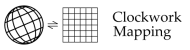
Longitude by Lunars
"Lunar Distances" or lunars for short were used to determine longitude at sea in the period from about 1767 until 1850 (and rarely after that date). This was a time when chronometers were not yet widely available at a reasonable price and were considered unreliable on long voyages. The principle behind lunars is simple. The Moon in the sky is the hour hand of a great clock. The stars along its path are the numbers on the face of the clock. If we can measure the Moon's position relative to the stars, we can read the time from the clock. Comparing that absolute time with local time, usually determined by a time sight, we have our longitude. A one hour difference in time corresponds to a 15 degree difference in longitude.-
Predicted Lunars (UPDATED)
Traditionally, lunar distances could be used for navigation only if a navigator had access to predicted distances. These were published in almanacs around the world from the late 18th through the early 20th centuries. Today the predicted distances are no longer published, but they can be calculated without much difficulty. The predictions generated by this web site are extremely accurate. They are the most accurate available today. The time period covered is 1750 to 2050 so the predictions here can be used for modern lunars or for analysis of historical lunar observations. -
Clear a Lunar (UPDATED)
This web-based app will analyze a lunar observation and generate your longitude in a fraction of a second. Historically, the analysis of lunars required about twenty minutes of work and a table of logarithms. Even if you decide to work a lunar by hand with pencil and paper, this online calculator will allow you to check your results. Originally developed and made available online in the summer of 2004, this app has been field-tested by myself and other navigation enthusiasts thousands of times. Its results are accurate to approximately one second of arc. -
Online Nautical Almanac (UPDATED)
A complete source for Nautical Almanac ephemeris data covering the period 1750 to 2050. The positions of the Sun, Moon, navigational planets and stars are generated for every hour of the day at a high level of accuracy just as in the published almanacs. This online app permits customization of display options so that data are generated that are relevant for your location and interests. -
Easy Lunars
An account of a simple technique for analyzing lunars using nothing more than the basic corrections and data in the Nautical Almanac and a handheld calculator. Lunars are not difficult. They take a little practice, and you may have to re-familiarize yourself with the use of a calculator, but any navigator can enjoy the challenge and experience of this historical method of navigation.
Comments:
John Brown wrote: 6👍
Captain Richard D. Buchanan wrote: 6👍
I have taken Frank's Modern Celestial Navigation class twice. I am always inspired and I always come away with a few practical techniques and more than a few insights into the history and beauty of celestial navigation. You owe it to yourself to enjoy this class, whether or not you are a mariner.
Greg Rudzinski wrote: 6👍
The online class "Lunars: Finding Longitude by Lunar Distance" was a very interesting introduction to the esoteric history of lunars as practiced at sea in the pre chronometer 18th century tall ship era. Practical instruction was also done demonstrating the physical process of observing a lunar with a sextant followed by a how to lunar sight reduction example using a pocket calculator, formulae, and tables. A very rewarding experience.
Greg Rudzinski
Retired Merchant Mariner
SUNY Maritime class of 80
Greg Rudzinski
Retired Merchant Mariner
SUNY Maritime class of 80